Jr Drones

logoblue

OUR SERVICES

AERIAL/DRONE VIDEOGRAPHY SURVEY

 “Aerial Mastery: Elevating Precision and Efficiency in Project Assessment”

“Experience precision and efficiency with our aerial drone videography. Our cutting-edge technology captures high-resolution insights, ensuring comprehensive project documentation. From safety-first approaches to customized solutions, we redefine surveying with accuracy and speed. Elevate your assessments with our aerial mastery for grounded results.”

  • Elevate Your Perspective: Elevate your perspective for unparalleled insights.
  • Precision in Every Frame: Uncover details that traditional surveys may miss.
  • Seamless Survey Solutions: Providing efficient and accurate solutions for diverse projects.
  • High-Resolution Aerial Insights: Unlock high-resolution aerial insights with our drone videography services

2D MAPPING

Enhance Your Mapping Experience with Drone 2D Precision”

“Transform your mapping experience with our drone 2D mapping services. From capturing intricate details to providing efficient solutions, our technology redefines the mapping landscape. Seamlessly integrating into your workflows, our drone 2D mapping ensures accuracy in every pixel. Enhance your projects with the power of precise mapping at your fingertips.”
  • Seamless Workflow Integration: Our drone 2D mapping seamlessly integrates into your existing workflows for a smooth and efficient process.
  • Efficient Solutions, Efficient Results: Efficiency is key. Our drone 2D mapping solutions provide quick and accurate results for your projects.
  • Pixel-Perfect Accuracy: Our technology ensures pixel-perfect accuracy in every aspect of the mapping process.
  • Transformative Technology: Transform your mapping with the cutting-edge technology embedded in our drone 2D mapping services.
  • Tailored to Your Needs: We understand that every project is unique. Our drone 2D mapping services are tailored to meet your specific mapping requirements.

3D MODELING

Crafting Precision with Drone 3D Modeling Expertise”

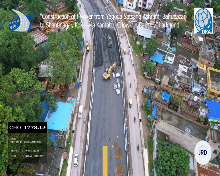
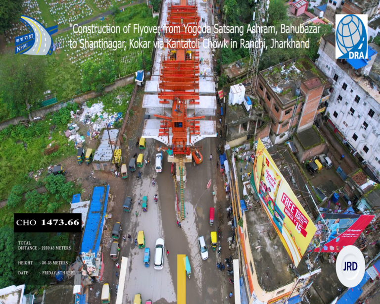
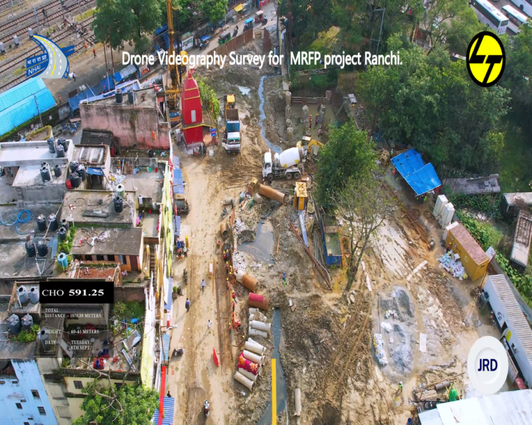
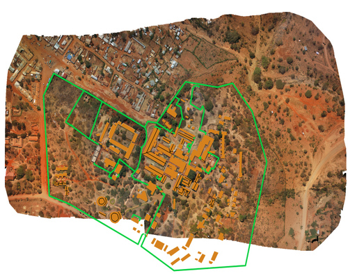
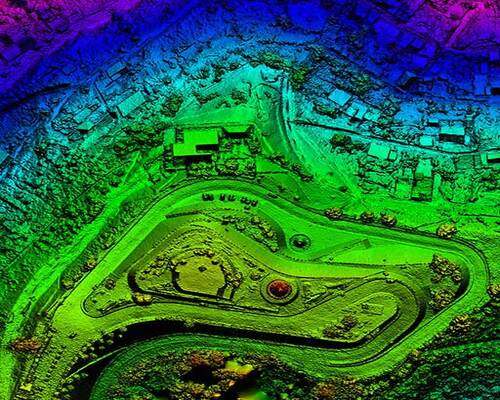
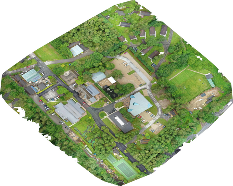
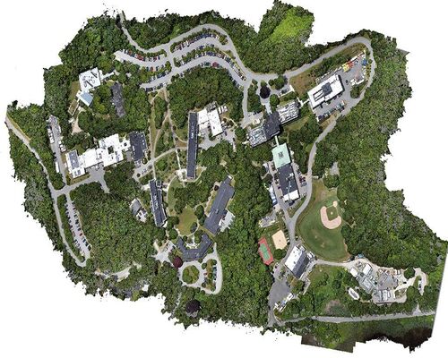
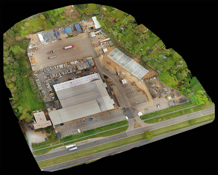
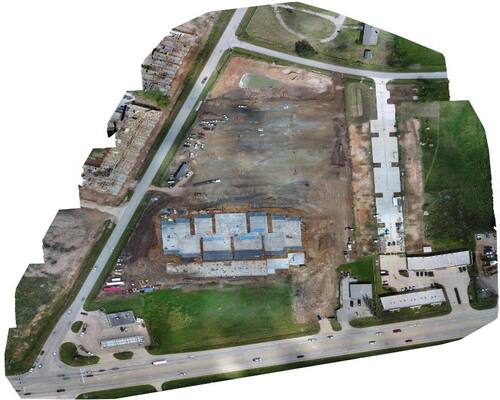
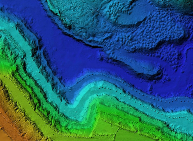
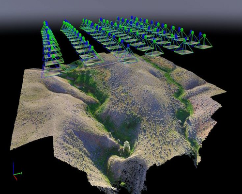
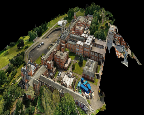
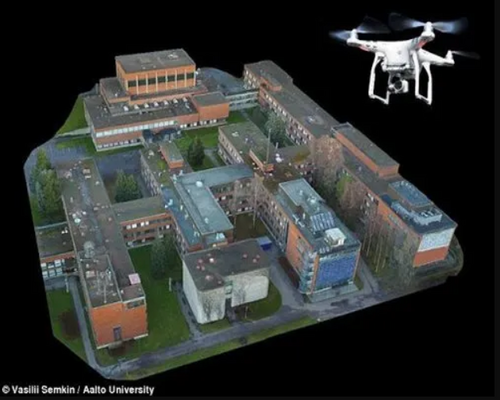
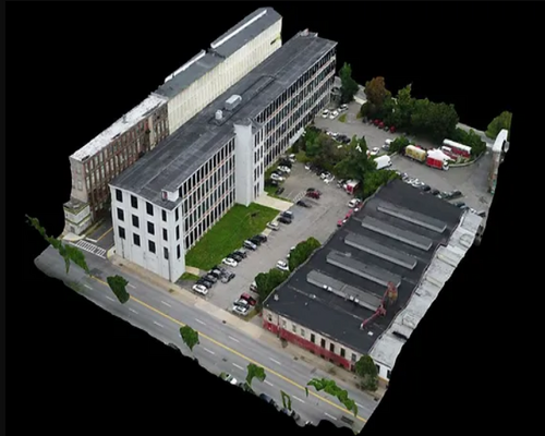
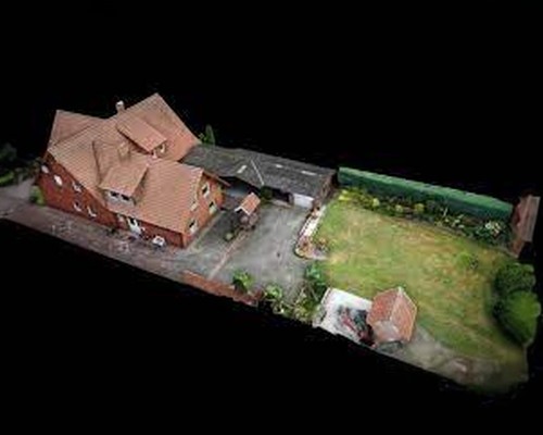
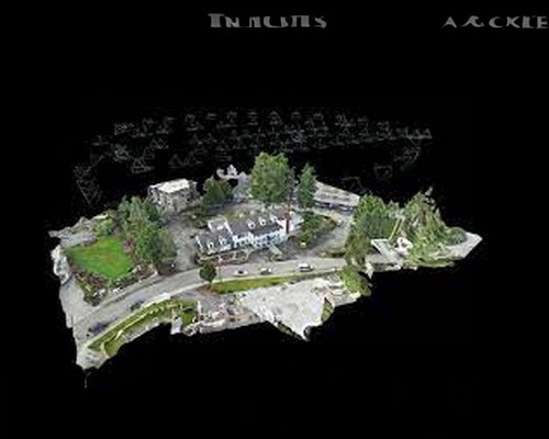
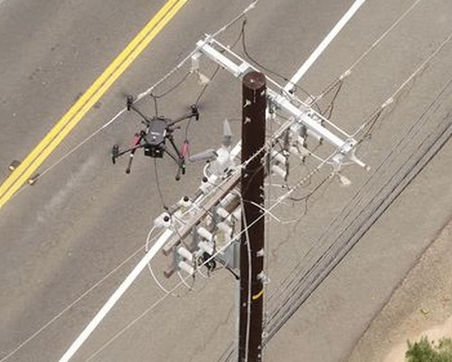
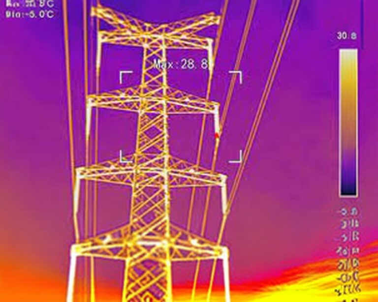
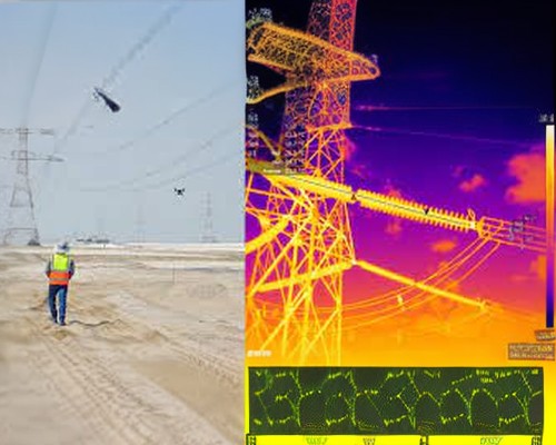
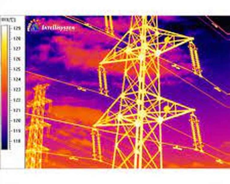
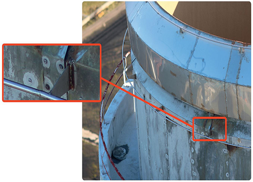
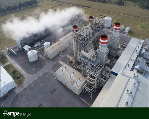
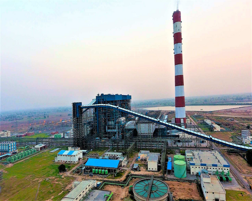
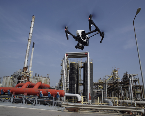
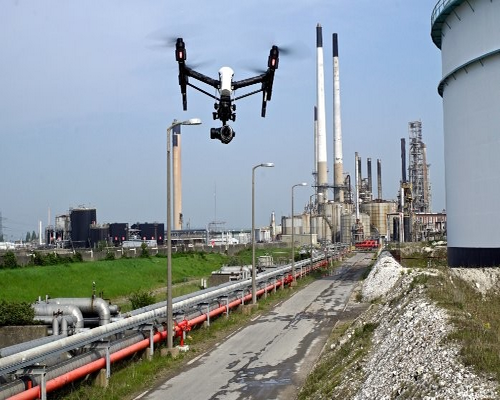
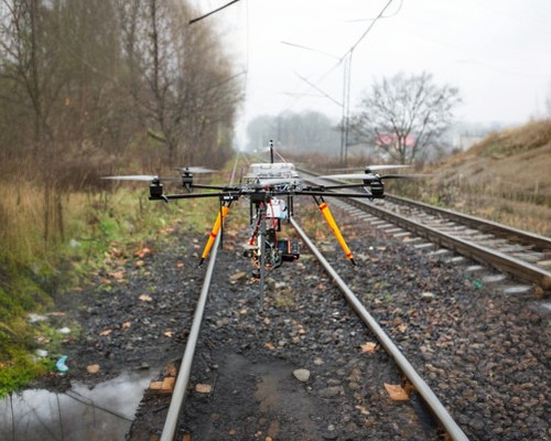
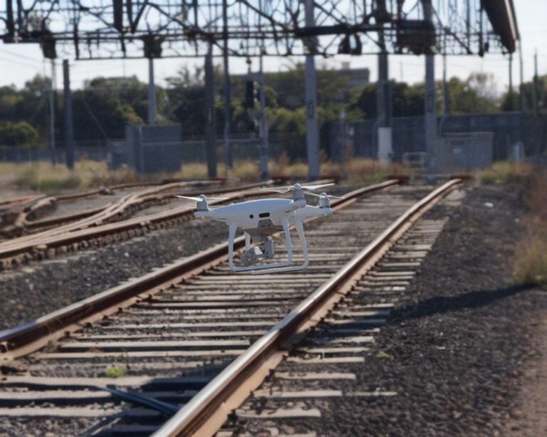
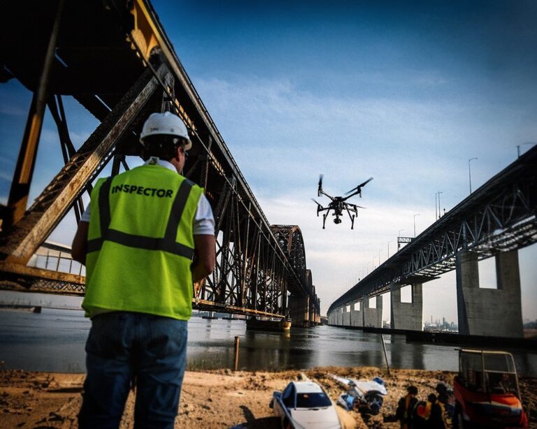
“Embark on a journey of meticulous craftsmanship with our Drone 3D Modeling services. Seamlessly integrating into your workflow, our cutting-edge technology meticulously captures intricate details, ensuring unparalleled accuracy. Amplify your project insights and decision-making with high-resolution 3D modeling at your fingertips. Redefine efficiency, excellence, and the future of modeling with us.”
  • Precision Redefined: “Crafting excellence with Drone 3D Modeling. Unparalleled accuracy, intricate details.”
  • Seamless Integration, Flawless Results“Efficient integration, flawless 3D results. Elevate every detail.”
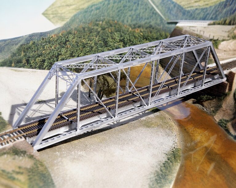
  • Amplify Project Vision: “Drone 3D Modeling expertise for visionary projects.”
  • Meticulous Craftsmanship, Maximum Impact: “Meticulous Drone 3D Modeling. Every detail, maximum impact”

POWERLINE INSPECTION

Soaring to New Heights: Revolutionize Your Powerline Surveys with Aerial Innovation!

Soar to success with Aerial POWERLINE Surveys! Elevate your projects with a bird’s-eye view, capturing every detail from above. Our aerial surveys bring precision and perspective to your powerline inspections, providing high-resolution insights that set you apart. Harness the power of innovation and efficiency with Aerial POWERLINE Surveys – where excellence meets the sky!
  • Increased accuracy and data quality
  • Reduced inspection time and costs
  • Safer, faster, and more efficient
  • Access to hard-to-reach areas
  • Inspection data is compatible with all major management system

PLANT & FACTORY INSPECTION

Revolutionizing Facility Oversight: Seamless Plant and Factory Inspections with Drone Precision!”

Transform your approach to plant and factory inspections with cutting-edge drone technology! Our drone inspections redefine efficiency and precision, allowing you to navigate and capture every detail of your facility effortlessly. From assessing infrastructure integrity to identifying potential issues, our aerial surveys provide a comprehensive view from above. Maximize safety, minimize downtime, and elevate your inspection processes with the power of drone technology. Upgrade to a smarter inspection solution today

  • Efficiency Redefined: Streamline plant and factory inspections with cutting-edge drone technology.
  • Comprehensive Insight: Capture every detail effortlessly, from infrastructure integrity to potential issues.
  • Aerial Precision: Elevate your perspective with a bird’s-eye view, ensuring a thorough examination of your facility.
  • Safety Maximization: Enhance safety protocols by minimizing on-site presence and reducing the risk of accidents during inspections.
  • Downtime Reduction: Minimize operational disruptions by swiftly identifying and addressing issues through proactive aerial surveys.
  • Smart Inspection Solutions: Embrace the future of inspections, optimizing processes and upgrading to a more intelligent approach.

RAILWAYS INSPECTION SERVICE USING DRONES

Optimizing Rail Safety: Advanced Drone Solutions for Efficient Inspections”

Enhance railway inspections with our advanced drone tech. Say goodbye to traditional methods and embrace efficiency. Our drones provide a comprehensive aerial view for assessing tracks and infrastructure. Improve safety, reduce downtime, and stay on track with innovation!

  • Streamlined Inspections: Harness the power of advanced drone tech for swift and efficient railway assessments.
  • Farewell to Tradition: Bid adieu to conventional methods and welcome the efficiency of drone-powered inspections.
  • Aerial Precision: Obtain a comprehensive view of track conditions and infrastructure integrity from above.
  • Safety Advancements: Enhance safety measures by minimizing on-site risks during inspections with drone technology.
  • Minimized Downtime: Identify and address issues promptly, reducing operational disruptions through proactive aerial surveys.
  • Innovative Railway Maintenance: Stay ahead with innovation, optimizing overall strategies for enhanced railway performance.

Reach Out Now

Unlock the Future - Contact Us Now.

Elevate your projects with precision drone surveys. Contact us now to unlock the future of data

Scroll to Top
Call Now Button